Product Overview
- No Lamination Required.
- Printed on Premium Thick Plastic and Cut.
- This material is ready to start using. No other prep work is needed.
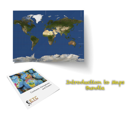
Based on the Miller geographical projection, this set of activities is ideal for helping introduce your children and students to the world and the various continents, and oceans. Includes longitude and latitude lines with labels of all the major lines such as the:
- Prime Meridian
- International Date Line
- Arctic Circle
- Tropic of Cancer
- Equator
- Tropic of Capricorn, and
- Antarctic Circle
Printed on flexible vinyl, this giant map measures 40" across by 30" high and doesn't require lamination. This complete set includes the complete three-part nomenclature for lower elementary with pictures, labels, all the control charts, and booklets on the continents, hemispheres and oceans of the world.
Ideal for use in geographic education, and for helping students understand maps, identify biomes, and other physical features of the earth.
Includes:
World Continents, Hemispheres and Oceans 3 Part Cards (ELC-5001)
Giant Map of the World (ELC-5002)
RESOURCES
Look at our Geography Flow Chart for Lower Elementary to see how this work fits in with the traditional Montessori geography curriculum.
STANDARDS
View the Standards met through this material.
SUGGESTED CONTAINERS
1 Acrylic Sorters and
1 set of Plastic Sleeve Holders (will utilize 2 sleeves)


