Product Overview
- No Lamination Required.
- Printed on Premium Thick Plastic and Cut.
- This material is ready to start using. No other prep work is needed.
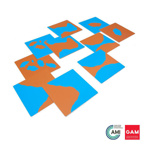
The set depicts the 10 different land and water formations separated as follows:
Land Formations:
- Island
- Peninsula
- Archipelago
- Cape
- Isthmus
Water Formations:
- Lake
- Gulf
- Bay
- Strait
- Chain of Lakes
Contains the following:
- 1 Booklet
- 2 Wall Chart
- 3 Part Nomenclature with labels totaling 60 cards
RESOURCES
Look at our Geography Flow Chart for Lower Elementary to see how this work fits in with the traditional Montessori geography curriculum.
STANDARDS
View the Standards met through this material.
SUGGESTED CONTAINERS
3 Clear Snap Envelopes - Small or 1 set of Plastic Sleeve Holders (will utilize 3 sleeves)


